Water Sustainment

Mitchell Lake

Mitchell LakeMitchell Lake in San Antonio, Texas is a single-purpose, ecosystem restoration, general investigation project that was studied due to its national significance in the Central Flyway allowing for a large biodiversity of habitats, which provide the requisite migratory needs of over 338 bird species. The study officially started with the signing of the Feasibility Cost Share Agreement between the U.S. Army Corps of Engineers and the San Antonio Water System on September 27, 2018. A combination Charette and Alternatives Milestone Meeting was successfully conducted on January 16, 2019. The Tentatively Selected Plan was determined at the successful milestone meeting held October 25, 2019. The Tentatively Selected Plan was confirmed as the Recommended Plan at the Agency Decision Milestone Meeting on April 23, 2020. Due to the relatively low cost to implement the plan, it was decided that the most appropriate path would be to continue the construction under the Continuing Authorities Program (CAP). The decision document for projects converted to CAP is a Detailed Project Report and Integrated Environmental Assessment.

More information about the Mitchell Lake Project...

Dallas Floodway

Dallas FloodwayThe Fort Worth District's Dallas Floodway Project is located in Dallas, Texas. It is a complex project in cooperation or partnership with multiple units of local, state and federal government. It addresses a number of regional concerns, although flood protection for the citizens of Dallas remains the cornerstone of this multi-faceted effort.

The U.S. Army Corps of Engineers has oversight responsibility for all activities within the federally authorized Dallas Floodway System. The Corps' Fort Worth District is a lead actor in some of the projects, such as the existing Dallas Floodway, which was strengthened and improved by USACE in the 1950s to reduce the risk of flooding. It was designed to handle a Standard Project Flood event. In other projects within the confines of the Dallas Floodway listed below, the Corps plays a smaller supporting role or perhaps only an oversight function.The Dallas Floodway Project is located along the Trinity River upstream from the abandoned Atchison, Topeka and Santa Fe (AT&SF) trestle to the confluence of the West and Elm Forks, then upstream along the West Fork for approximately 2.2 miles, and upstream about 4 miles along the Elm Fork.

More information about the Dallas Floodway Project...

Dallas Floodway Extension

Dallas Floodway ExtensionThe Dallas Floodway Extension (DFE) Project is located in Dallas, Texas, along the Trinity River beginning where the Dallas Floodway ends (at the abandoned Atchison, Topeka and Santa Fe trestle) and extending downstream to the area where IH-20 and Dowdy Ferry Road intersect. It is a complex project in cooperation and partnership with multiple units of local, state and federal government. It addresses a number of regional concerns, although reducing flood risk for the citizens of Dallas remains the cornerstone of this multi-faceted effort.

The U.S. Army Corps of Engineers has oversight responsibility for all activities within the federally authorized Dallas Floodway System. The Corps' Fort Worth District is a lead actor in some of the projects, such as the Dallas Floodway Extension Project here. In other projects within the confines of the Dallas Floodway Extension Project listed below, the Corps plays a smaller supporting role.

More information about the Dallas Floodway Extension (DFE) Project...

San Antonio Mission Reach

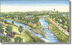
San Antonio Mission ReachThe Mission Reach project occurs along eight miles of the San Antonio River and represents the initial steps toward adding the later authorized purposes of ecosystem restoration and recreation to previously channelized streams. Features are designed to maintain the existing level of flood risk mitigation while restoring aquatic ecosystem function lost due to channelization.

The Mission Reach includes restoration of pool-riffle-run sequences, river remnants, off-channel pools, sinuosity, and aquatic and riparian vegetation. Recreation is included as an ancillary, non-disruptive component of the restoration to facilitate learning, enjoyment, and interpretive opportunities for the role of the natural riverine environment in the establishment of four Spanish Colonial Missions. These missions are part of the Missions National Park, which are situated along the 8-mile Mission Reach. When complete the Mission Reach project will restore approximately 435 acres of riverine ecosystem and provides 56,000 linear feet of multi-purpose trails.

The first mile of the Mission Reach channel work has been completed, and the remaining 7 miles are under construction. A timeframe of two years is allowed after the completion of the channel work for the establishment of native herbaceous plants, grasses and wildflowers, before the final phase of construction is implemented, which is planting approximately 20,000 trees along the riparian corridor.

More information about the San Antonio Mission Reach Project...

Trinity River Central City, Fort Worth

The Central City Project is located within the vicinity of the downtown area of Fort Worth, Texas, along the West Fork and Clear Fork of the Trinity River and consists of a bypass channel, levee system, and associated improvements to divert flood flows around a segment of the existing floodway system. Included in the Corps of Engineers (Corps) portion of the project are hydraulic (valley storage) and related environmental and cultural resource mitigation requirements. Federal costs of the Corps portion of Central City Project are defined by PL 108-447 at $110,000,000. The non-Federal sponsor is the Tarrant Regional Water District and the City of Fort Worth is one of the local partners. These entities are also sponsors for the Riverside Oxbow Ecosystem Restoration Project, which encompasses about 1,060 acres along a 3-mile reach just downstream of the Central City Project including a portion of the old natural channel of the West Fork that was severed as a cut-off oxbow when the channel was realigned. Federal Cost for the Riverside Oxbow project is estimated (2002 price levels) at about $8,300,000.

More information about the Central City Project, Upper Trinity River...